The lighthouse at Needles Channel is flashing a steady Red (Iso.R.2s), and I’m watching the cross-track error (XTE) on my plotter climb. The current is pushing us sideways at three knots. In coastal navigation, the shore isn't just a destination; it’s a dynamic, often hostile boundary that requires constant mathematical vigilance.
As an RYA Yachtmaster with over 40,000 miles logged, I’ve learned that the biggest danger to a vessel isn't the open ocean, it’s the coastline. This is where the variables of tide, current, traffic, and underwater hazards converge. In this "Masterclass," we move beyond basic chart reading and into the technical discipline of professional coastal pilotage. By the end of this guide, you will be able to calculate tidal height using the Rule of Twelfths, interpret IALA buoyage in unfamiliar waters, and apply COLREGs Rule 10, the skills that separate confident passage-makers from anxious ones.
About this guide: All navigation techniques, COLREGs references, and tidal calculations described here are based on Captain Jack's 40,000+ miles of offshore passage-making and his active role as a navigational safety auditor for luxury yacht charters. COLREGs quotations are cross-referenced with the IMO's official collision regulations. IALA buoyage system references reflect the current IALA A/B framework as of 2026.
Part I: The IALA Maritime Buoyage System
The ocean is literally signposted, but you need to know how to read the language. The world is divided into two regions (Region A and Region B).
- Region A (Europe, Africa, parts of Asia, Australia): "Red on the Left" (Port) when entering from seaward.
- Region B (Americas, Japan, Korea, Philippines): "Red on the Right" (Port) when entering from seaward.
Lateral Marks Comparison
Understanding this distinction is the difference between a safe entry and a grounded keel.
| Mark Type | IALA Region A (Color/Shape) | IALA Region B (Color/Shape) | Tactical Action |
|---|
| Port Hand | Red / Can | Green / Can | Leave to Port upon entry |
| Starboard Hand | Green / Cone | Red / Cone (Red, Right, Returning) | Leave to Starboard entry |
| Safe Water | Red/White Vertical Stripes | Red/White Vertical Stripes | Pass close to or navigate mid-channel |
| Isolated Danger | Black/Red Horizontal Stripes | Black/Red Horizontal Stripes | Pass with wide berth (danger below) |
Part II: Mastering Tidal Calculations
In coastal waters, "depth" is a moving target. To navigate safely, you must master the Rule of Twelfths and Secondary Port corrections.
The Rule of Twelfths
This is a professional's tool for estimating the height of tide at any given hour between high and low water. It assumes a 6-hour tidal cycle.
- 1st Hour: Tide rises 1/12 of its range.
- 2nd Hour: Tide rises 2/12.
- 3rd Hour: Tide rises 3/12.
- 4th Hour: Tide rises 3/12.
- 5th Hour: Tide rises 2/12.
- 6th Hour: Tide rises 1/12.
| Tidal Hour | Height Increase (Fraction) | Cumulative Rise | Risk Level |
|---|
| Hour 1 | 1/12 | 8% | Safe for shallow entries |
| Hour 2 | 2/12 | 25% | Rapid change begins |
| Hour 3 | 3/12 | 50% | Maximum current flow |
| Hour 4 | 3/12 | 75% | Maximum current flow |
| Hour 5 | 2/12 | 92% | Surge slowing |
| Hour 6 | 1/12 | 100% | High/Low Water slack |
Part III: The COLREGs (Rules of the Road)
The International Regulations for Preventing Collisions at Sea (COLREGs) are the laws of the ocean. Compliance is mandatory, not optional.
Rule 12 & 13: The STAND-ON vs. GIVE-WAY Hierarchy
In an encounter, one boat is designated to maintain course and speed (Stand-on), while the other must take early and substantial action to avoid a collision (Give-way).
| Encounter Type | Give-Way Vessel | Stand-On Vessel | Technical Rule |
|---|
| Overtaking | The boat coming from behind | The boat being overtaken | Rule 13 |
| Head-on | Both boats turn to Starboard | Neither (both give way) | Rule 14 |
| Sailing Proper | Boat on Port Tack | Boat on Starboard Tack | Rule 12 |
| Sail vs Power | The Power-driven vessel | The Sailing vessel | Rule 18 |
| NUC (Not Under Command) | Everyone else | The NUC vessel | Rule 18 |
Part IV: Navigational Redundancy (Paper vs. Pixels)
A professional navigator never relies on a single source of truth. Electronics fail precisely when you need them most.
The Standard Yachtmaster Bridge Kit:
- Digital: B&G Zeus at the helm + Navionics on a tablet (isolated power source).
- Paper: Up-to-date Admiralty or Imray charts + 2B pencils + parallel rulers.
- Active Sensing: Radar (to see in fog) + AIS (to see around corners).
| Equipment | Professional Model | Rationale | Technical Spec |
|---|
| Radar | Garmin GMR Fantom | 48-mile range, Doppler tracking | 4kW Pulse Compression |
| AIS | Vesper Cortex V1 | B+ SOTDMA Transponder | 5W High-Priority Ping |
| Echosounder | Raymarine CP370 | High-resolution sonar | 1kW Output power |
| Compass | Silva 70P | Zero-interference dampened | 5° graduation |
| Pilot Book | Reeds Nautical Almanac | The "Bible" of navigation data | Updated Annually |
Part V: Night Piloting & Fog Signals
When visual cues are removed, you must navigate by sound and light patterns.
| Signal Type | Meaning | Light/Sound Sequence |
|---|
| Power-driven | Making way in fog | 1 prolonged blast (4–6s) every 2 mins |
| Sailing/Towing | Underway in fog | 1 prolonged + 2 short every 2 mins |
| Port Entry (R.A) | Entering channel | Red Flashing (any frequency) |
| East Cardinal | Danger to the West | 3 short flashes every 10s |
| South Cardinal | Danger to the North | 6 short + 1 long every 15s |
The Philosophical Payoff: The Art of Arrival
Coastal navigation is an exercise in humility. You are constantly making assumptions based on historical data (tide tables), and then verifying those assumptions against the messy, real-time reality of the ocean.
When you successfully navigate a narrow channel at night, cross-referencing your radar overlay with the flashing buoy on your port bow, and finally drop anchor in the precise spot you planned four hours ago, there is a sense of accomplishment that no GPS can provide.
It’s the realization that you aren't just a passenger; you are an active participant in the physical world. Navigation is the bridge between the abstraction of the chart and the reality of the sea.
Stay alert. Trust your math. And always look over your shoulder.
Part VI: Dead Reckoning (DR) and Estimated Position (EP)
The most common failure in modern navigation is "Screen Fixation." If your chartplotter dies, do you know where you are?
6.1 The DR (Dead Reckoning)
Dead Reckoning is the process of calculating your position based solely on your Course Steered and your Distance Run through the water.
- The Math: If you steer 090° (True) at 6 knots for 1 hour, your DR position is exactly 6 miles East of your starting point.
- The Flaw: DR does not account for wind (leeway) or current (tide). It is a "Water-Only" calculation.
6.2 The EP (Estimated Position)
An Estimated Position is a DR that has been corrected for the environmental forces of Set and Drift.
- The Logic: If the tide is pushing you North at 2 knots, your EP will be 2 miles North of your DR. This is the "True" position where your boat is actually located on the earth's surface.
Part VII: Set and Drift: The Vector Triangle
Navigation is a game of vectors. To arrive at a specific buoy in a strong cross-current, you cannot steer directly at the buoy.
7.1 Course to Steer (CTS)
To calculate your CTS, you must draw a Vector Triangle:
- Draw your intended track on the chart (the ground track).
- Draw a vector representing the tidal current (Set and Drift) from your starting point.
- Use a pair of dividers set to your boat's speed (STW) to intersect your intended track.
- The Result: The angle of that third line is the Course to Steer. You might find yourself steering 080° to keep a ground track of 090°. This 10-degree "crab" into the current is what keeps you from being swept onto a shoal.
Part VIII: The 3-Bearing Fix: Hand-Bearing Compass Masterclass
If you have a clear view of the shore, you should be able to plot your position with a Hand-Bearing Compass (like a Silva 70P).
8.1 Why Three Lines?
A single bearing gives you a "Line of Position" (LOP). You are somewhere on that line.
- Two Bearings: Where the two lines intersect is your position. However, if one bearing is slightly wrong, you won't know it.
- Three Bearings: This creates a small triangle on the chart (often called a "Cocked Hat").
- The Diagnostic: If the triangle is small, your fix is accurate. If the triangle is large, your bearings are unreliable or your boat moved too much between readings.
- The Safety Rule: Always assume you are at the corner of the triangle closest to the nearest danger (the shore or a reef).
Part IX: Electronic Offsets and Datum Shifts
"But my GPS says I'm right here!"
9.1 The Datum Trap
GPS coordinates are calculated based on a mathematical model of the earth called a Datum (typically WGS84). However, many old paper charts (and some poorly digitized electronic ones) were drawn using older datums (like OSGB36).
- The Offset: If your chartplotter is set to WGS84 but the digital chart was scanned from an old local datum, your boat icon might be shown 100 feet to the East of where you actually are.
- The Coastal Rule: In tight channels or narrow harbor entries, Nav by Eye, not by Screen. Use the buoys and leading lights. If the screen says you have 50 feet of clearance but your eyes see a rock, trust your eyes.
Part X: The Callahan "Paper-to-Digital" Sync Protocol: 5 Steps to Certainty
- Plot a DR every hour: Even with a perfect chartplotter, mark your position on a paper chart once an hour. This ensures you have a starting point if the electronics fail.
- Verify the Depth: Use your echosounder to confirm the contour lines on the chart. If the chart says 30 feet and you see 15, you have a massive problem.
- Check the "True vs Magnetic": Ensure your chartplotter and your steering compass are both using the same reference. Mixing Magnetic and True headings in a calculation is a recipe for a 5-to-10 degree error.
- Audit the "Arrival Alarm": Set your "XTE" (Cross-Track Error) alarm to 0.1 miles. If the current pushes you further than that, the radio will alert you before you hit the bank.
- Identify "Leading Lights": Before entering an unfamiliar harbor at night, identify the specific light sequences (e.g., Fl(2) R 10s) on the chart. Don't just follow the "brightest light", that's usually a gas station on the shore.
Part XI: Summary: The Navigator's Mindset
Coastal navigation isn't about having the best equipment; it's about having the most Skeptical Mindset. A professional navigator is always looking for a reason to doubt the electronics. By mastering Tidal Vectors, The Rule of Twelfths, and the 3-Bearing Fix, you are providing your vessel with a level of safety that no satellite constellation can match.
I'll see you at the ramp!
Part XII: Advanced Radar Pilotage: Parallel Indexing
When visibility is zero and you are navigating a narrow channel, you cannot rely on GPS alone. You must use Parallel Indexing (PI) on your radar.
12.1 The PI Technique
- Identify a solid, vertical radar target on the chart (like a lighthouse or a bridge pier).
- On your radar screen, draw a line parallel to your intended course, but offset by the distance you want to pass that target.
- The Goal: As you drive the boat, keep the radar blip of the target touching that line.
- The Result: If the blip stays on the line, you are exactly on your intended track. If the blip moves away from the line, you are being pushed by the current or wind. This is the fastest and most accurate way to stay in a channel without looking at a chartplotter.
Part XIII: The "Rule of Twelfths" in Action: A Working Scenario
Let's walk through a real-world calculation. You are entering a harbor with a 12-foot tidal range. Low Water (0 feet) is at 12:00 PM. High Water (12 feet) is at 6:00 PM. You need to know if you have enough depth for your 5-foot draft boat at 2:00 PM.
- Hour 1 (12:00-1:00): Tide rises 1/12 of 12ft = 1 foot. Total depth = 1ft.
- Hour 2 (1:00-2:00): Tide rises 2/12 of 12ft = 2 feet. Total depth = 1ft + 2ft = 3 feet.
- The Conclusion: At 2:00 PM, there is only 3 feet of water. Your 5-foot draft boat will be aground. You must wait until at least 3:30 PM (Hour 3 adds 3/12 = 3ft, total 6ft) to safely enter.
- The Callahan Safety Margin: Always subtract 1 foot from your tidal calculation for "Atmospheric Pressure" changes. If the barometer is high, the tide will be lower than the table predicts.
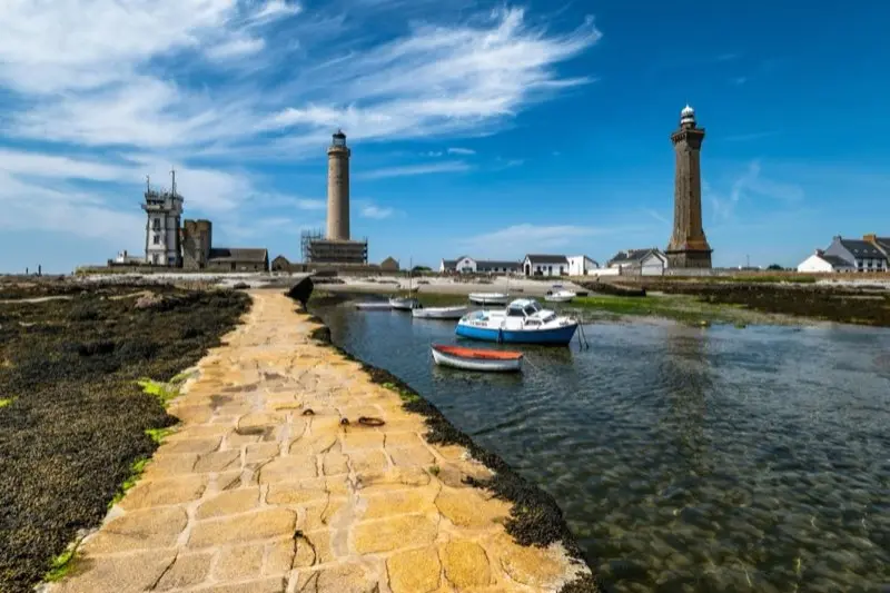
Part XIV: Night Vision and Light Signatures: Reading the "Loom"
At night, you often see a lighthouse before you see the light itself. This is called the Loom.
14.1 Identifying the Light
Every light has a specific "Character" (e.g., Fl(3) W 15s).
- Fl(3): Three flashes.
- W: White light.
- 15s: The total cycle takes 15 seconds.
- The Tactics: If you see a light flashing twice, but the chart says it should be three times, you are looking at the wrong light. Stop the boat. Re-evaluate. Do not assume "the chart is wrong." The lighthouse hasn't moved; your position has.
15. Summary Checklist: The Master Navigator's Protocol
- Confirm the Datum: Ensure your GPS and Paper Chart are synced (WGS84).
- Calculate the Drift: Use the Vector Triangle to find your Course to Steer.
- Monitor the Depth: Compare the echosounder to the tidal height (Rule of Twelfths).
- PI the Radar: Use Parallel Indexing to stay in the center of the deep water.
- Verify the Light: Time the sequence of every lighthouse with a stopwatch.
Coastal navigation is the ultimate marriage of classical physics and modern digital precision. Master these skills, and you won't just arrive at your destination, you'll arrive with the absolute certainty of a professional mariner.
I'll see you at the ramp!